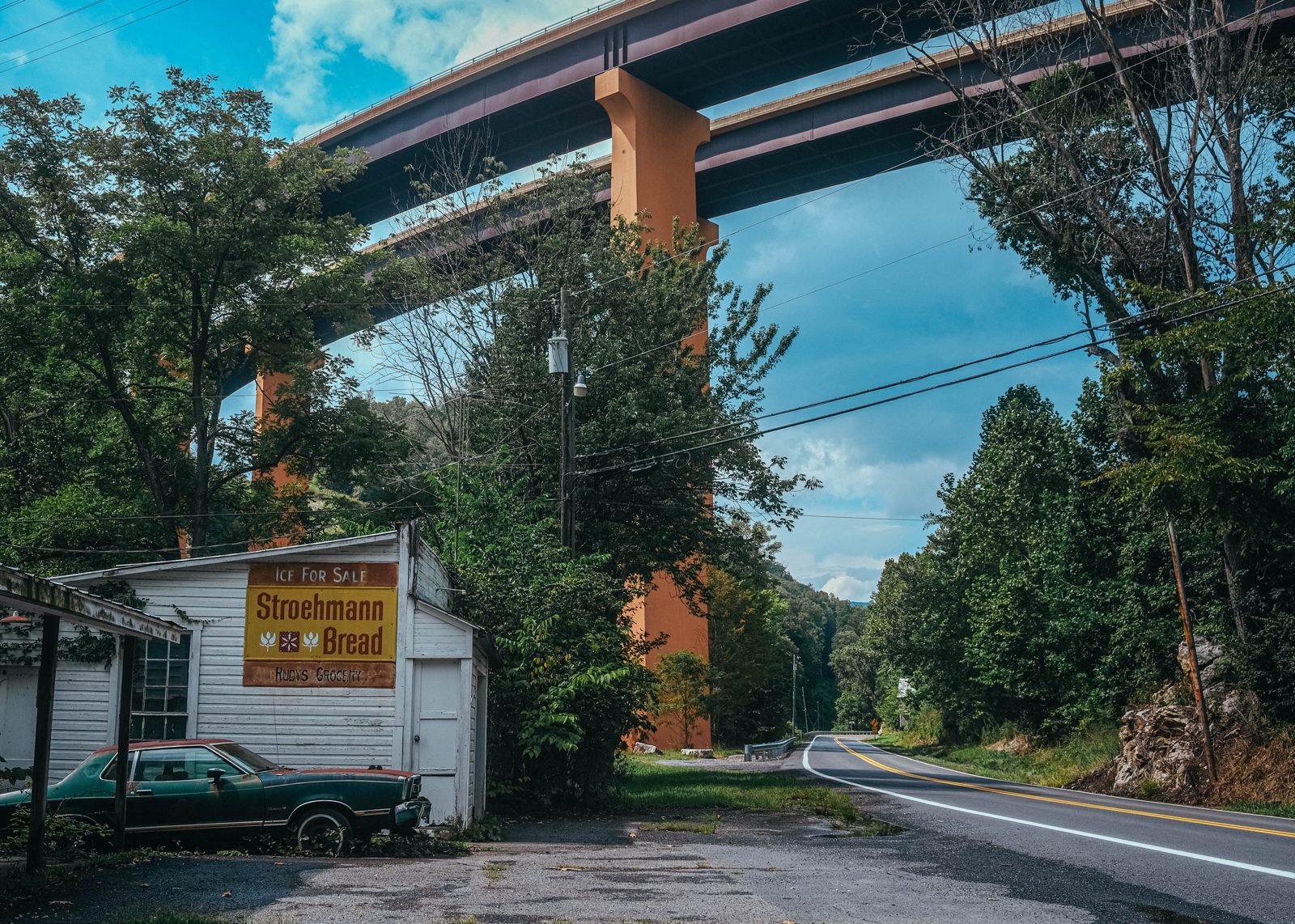
For a brief period in the late 2000s, US Route 48 truncated abruptly just shy of the town of Moorefield, WV. Four lanes downhill right into a reflective guardrail. It was an odd feeling. Behind it swayed green cornfields divided down the middle by a vast construction project: a $30 million bridge that would soon span the South Branch Potomac River and its floodplain. In the distance, on the far side of the valley, a brand-new section of Route 48 was graded and excavated, waiting for its connection.
“The waters of prosperity flow down rivers of concrete,” Democratic Senator Robert C Byrd of West Virginia was supposedly fond of saying. Byrd was a core champion of the Appalachian Development Highway System (ADHS), known otherwise as the Robert C Byrd Appalachian Highway System. US Route 48, known within the context of the ADHS as Corridor H, or the Robert C Byrd Highway, is one of a rat’s nest of 23 expressway corridors under-construction or completed as part of the System. Corridor H, the Robert C Byrd Highway of the Robert C Byrd Highway System, will be one of the last to be finished—if it gets there at all.
It’s two decades later and Corridor H remains a fragmented freeway. The Moorefield bridge is complete, yes, along with a new exit ramp, and the valley has filled in with fast food restaurants and a Walmart. Two segments totaling around 30 miles remain unfinished. Some of those miles—traversing the fourth-poorest state in the nation—will cost $100 million apiece to build. Some will almost certainly never be built. What has been completed is a menagerie of highway engineering marvels that cut and carve their way through the most rugged terrain on the East Coast. The resulting superhighway also happens to be mostly empty. A rush-hour graveyard.
The Appalachian Development Highway System was a downstream product of the President’s Appalachian Regional Commission (PARC), launched in 1963 as a federal-state partnership with the goal, generally, of making Appalachia less poor.
Indeed, by 1960, conditions in many Appalachian-region states were impoverished, particularly in West Virginia, where technology and a demand rout had left many in the coal mining industry jobless. John F Kennedy campaigned hard for the Democratic party’s presidential nomination here (eventually winning it), promising that as president he would save a beleaguered region. At one union event, he left with his politician’s blue suit coated in a black layer of coal dust.
The result of Kennedy’s PARC, the 1965 Appalachian Regional Development Act (ARDA), would pass after his death as part of Lyndon Johnson’s Great Society programs. A 1976 Report to Congress recalls, rather dryly, “In the early 196Os, the Congress recognized that several geographical regions had been bypassed by the general prosperity and growth of the Nation. This occurred in some regions because of depleted natural resources. Other regions suffered because they depended on a single industry adversely affected by technological change, competition, or obsolescence. A special effort was believed necessary to halt the decline and lift the economies of these regions to a level close to that of the rest of the Nation.”
ADHS, the highway system, was the largest component of the ARDA, the legislation. Just $800 million (a still-paltry $3 billion in 2026 dollars) was allocated in federal dollars for some 2,350 miles of new freeway, with another $350 million coming from the states. The new highways were expected to be completed in 1971.
The 1976 Report exists to explain to Congress why West Virginia’s promised new freeways were not in fact completed in 1971. Only 234 miles, or 57 percent, were either finished or under-construction by the time of its release. Much of the remaining work wasn’t scheduled to begin until after 1980.
The general reason for the delay was cost. Estimates for the completed highway work had more than doubled to $1.5 billion by the time of the Report. Part of it was inflation, a plague on public works projects that most recently eroded 2021’s infrastructure bill, which would nonetheless shovel money into West Virginia for its new highways. The period saw rates rise from under 2 percent in the early-1960s to 12 percent by 1976. (Inflation would wind up giving us the Reagan administration, which, interestingly enough, would starve the highway project of funding for its term and beyond.)
Inflation aside, everything about building roads became more difficult in the 1970s. Per a new federal law, relocation costs were going up for people and businesses uprooted by the new highways; highway safety and design standards were becoming more stringent; and new environmental protection legislation added fresh barriers to simply laying concrete and carving up mountainsides in Appalachia and beyond. In particular, the National Environmental Policy Act of 1969 now required environmental impact statements for “federal actions significantly affecting the quality of the human environment,” as the Report explains.
In 1976, the two largest of the six West Virginia highway corridors were effectively dormant. The first was Corridor G, known otherwise as US Route 119, which runs from the Kentucky state line into deep southwestern West Virginia. The state had nowhere to put displaced families, and, until their new homes could be sorted or until they died off, no ground could be broken.
This left Corridor H, proposed to run from Interstate 76 in the middle of West Virginia through the mountains to Interstate 81, in northwestern Virginia. The dream was something like a straight four-lane shot from the population and industrial centers (by WV standards) of Charleston and Huntington across the most rugged and beautiful terrain in West Virginia to, eventually, Washington DC and the Interstate 95 corridor.
Just think: a resident of Thomas, WV (pop. 263), an arts enclave and tourist destination, could hop on a Corridor H entrance ramp right in their backyard and be in Miami in 16 hours without so much as a traffic light or stop sign. Suddenly, with four high-speed lanes of Corridor H blasted through the ridge-line of Great North Mountain, the poultry-processing town of Moorefield could be a DC bedroom community.
That was the dream anyway, until several groups of determined environmentalists, enabled by new federal law and its Environmental Impact Statement (EIS) rule, intervened. Chief among Corridor H opponents was and is the West Virginia Highlands Conservancy, an organization that’s been fighting dams, data centers, mining companies, and, yes, highway projects since 1965. Its many accomplishments include keeping Smoke Hole Canyon above water, winning federal wilderness protections for Dolly Sods and many other areas in eastern West Virginia, and killing the Davis Power Plant project, which would have put a large swath of Canaan Valley underwater.
The originally planned Corridor H route into and through the Potomac Highlands, a loosely defined area centered around the rugged upper reaches of the Potomac River bordering Maryland and Virginia, was a nightmare only an American (or Chinese) highway engineer could devise.
It was obvious that current traffic numbers and future estimates did not justify four lanes between Elkins and the Virginia line, and on to I-81
This 100-mile section is the meat of Corridor H and it begins at Elkins, WV, a decently sized railroad town in a bend of the Tygart Valley River that acts as a sort of geographic and cultural guardhouse to the eastern West Virginia panhandle. The 40 mile section to the west of Elkins, leading to Interstate 76 through Buckhannon and the Allegheny foothills, was built over the course of two-ish decades in drips and drops with relatively little conflict. The terrain in this direction is pretty mild.
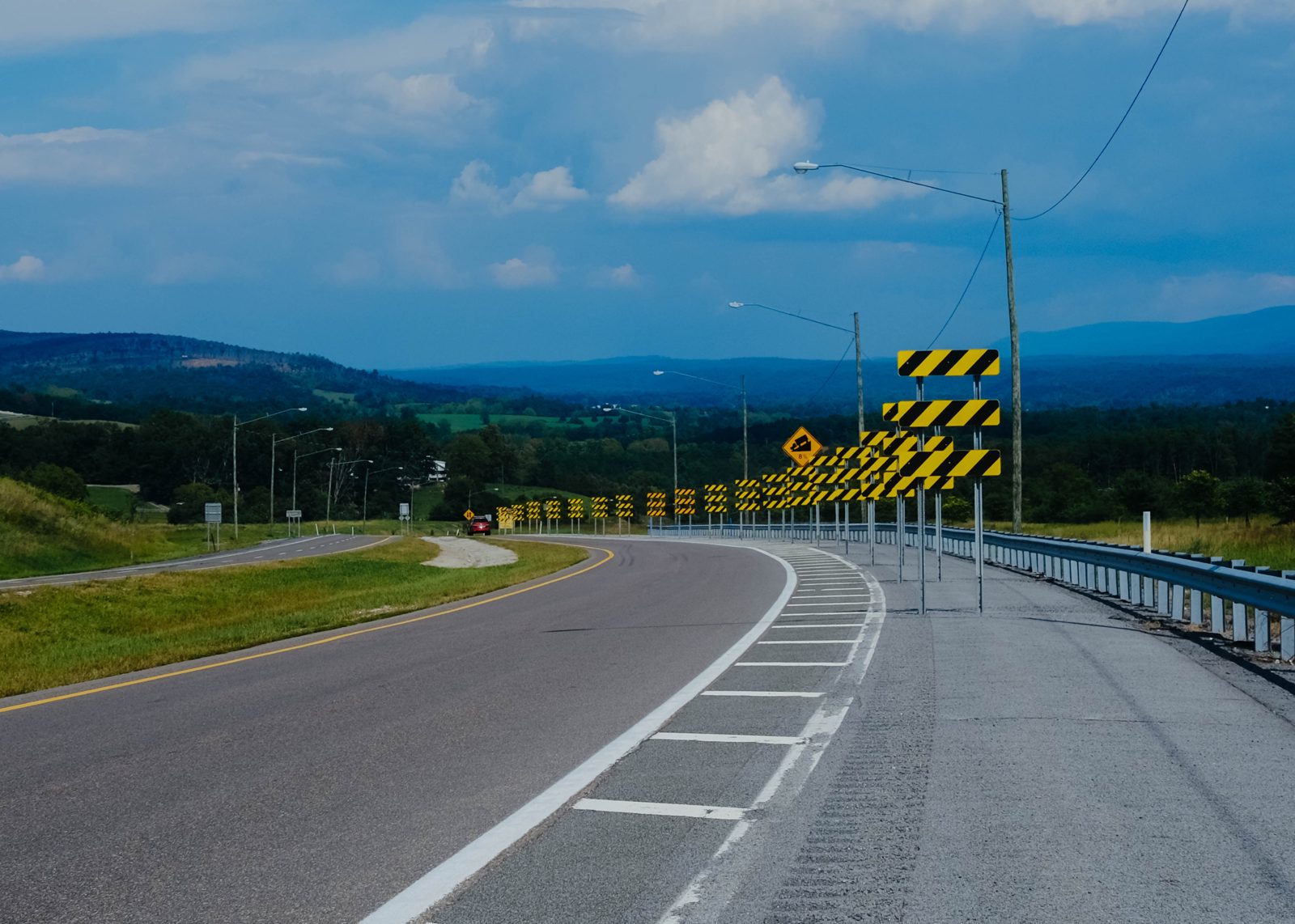
Originally, Corridor H was to violently carve and blast its way from Elkins right down to Seneca Rocks, following the twisty and often steep path of US Route 33 through the town of Bowden and over the Eastern Continental Divide.
We’re supposed to believe running a four-lane expressway along the foot of Seneca Rocks is something other than blasphemy. One early alignment went as far as to have the new highway climbing North Fork Mountain, which sits up and behind Seneca Rocks to the east, and then Foremost Mountain to eventually emerge in the Shenandoah Valley around New Market, Virginia.
Instead of the North Fork Mountain route, which met heavy opposition and was also absurd in engineering terms, planners imagined in the early ’90s that Corridor H would turn north at Seneca Rocks and follow Highway 55 through the isolated and sparsely populated South Branch Potomac River valley. It would eventually then link up with its current alignment in Moorefield, where we began.
This plan to extend Corridor H to Seneca Rocks from Bowden was unveiled along with a corresponding draft Environmental Impact Statement (EIS) in 1981, but was immediately shelved after the Reagan administration cut its funding. The Corridor H plans were resurrected in 1990, however, thanks to Robert C Byrd’s ascension to chair of the Senate Appropriations Committee. What followed was a full decade of legal war between the West Virginia Department of Transportation and a new org called Corridor H Alternatives, born from a collection of advocacy groups that includes the West Virginia Highlands Conservancy.
“It was obvious that current traffic numbers and future estimates did not justify four lanes between Elkins and the Virginia line, and on to I-81,” Hugh Rogers, the Highlands Conservancy’s Highways Committee chair, wrote in the Highlands Voice in 2017. “Hence the name, Corridor H Alternatives, and our campaign for an Improved Roadway Alternative.” That is, instead of building a new expressway, upgrade existing roads and highways.
What Corridor H Alternatives eventually won was a new northern route from Elkins that, instead of Seneca Rocks, clips the towns of Davis and Thomas and then curves around back east into Moorefield. It was a pyrrhic victory. “We can’t ignore that moving the highway meant moving the damage,” Rogers lamented.
This job features the moving of 10 million yards of material, the largest grade and drain project awarded in the state of West Virginia
The new alignment requires a bridge over an arm of Blackwater Canyon, a fragile area that advocates have pushed as a national park. The threat of the new highway led to the Blackwater River’s inclusion on American Rivers’ Most Endangered Rivers list in 2024. Corridor H would also split the two small Tucker County towns of Davis and Thomas, now separated by a stretch of forest (and, in fairness, a landfill). A proposed alternative, currently under consideration, would route the freeway north of Thomas in a big semicircle, skipping some of the more sensitive wildland areas.
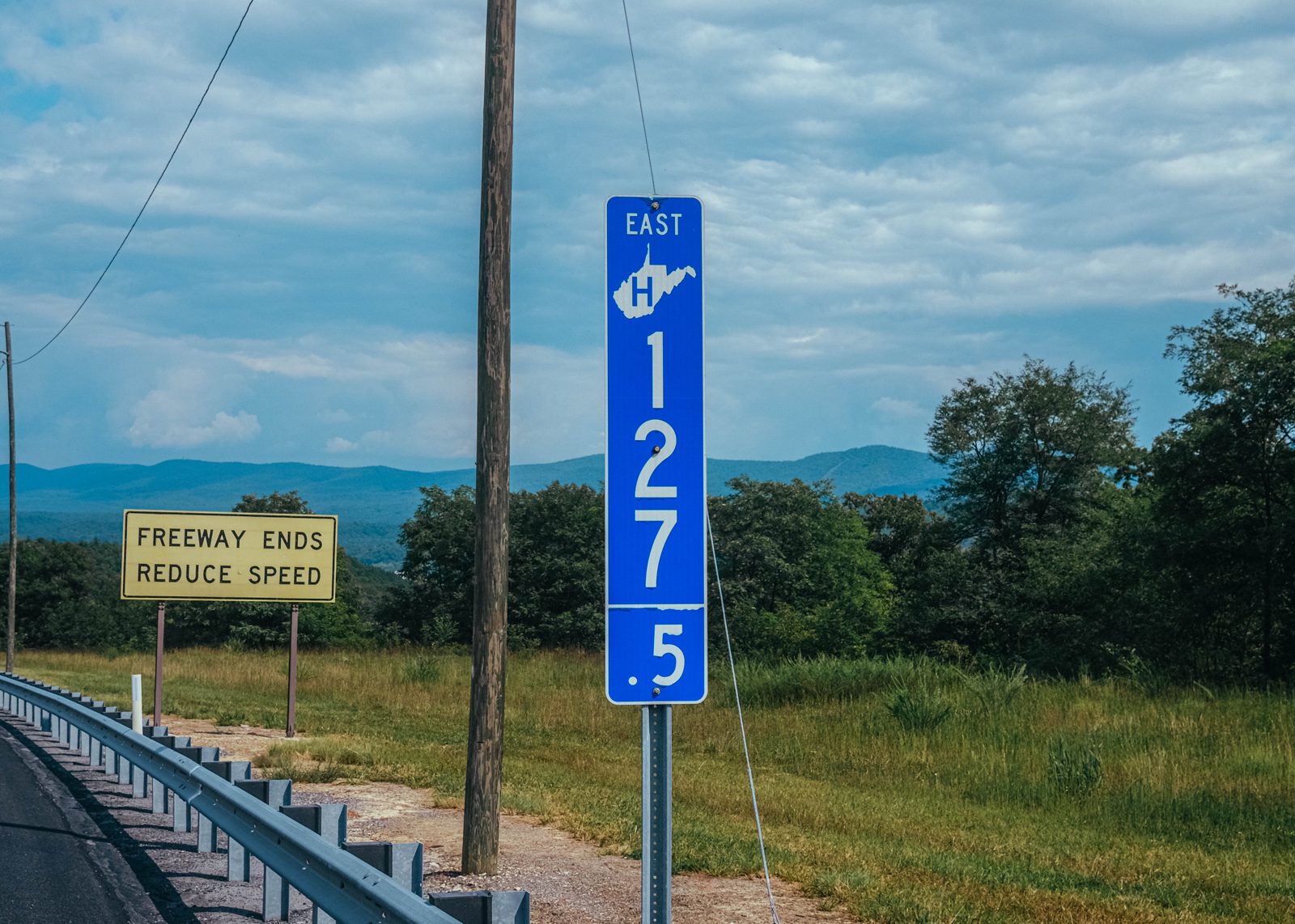
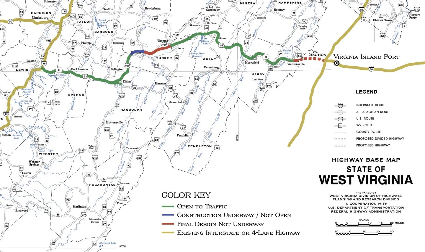
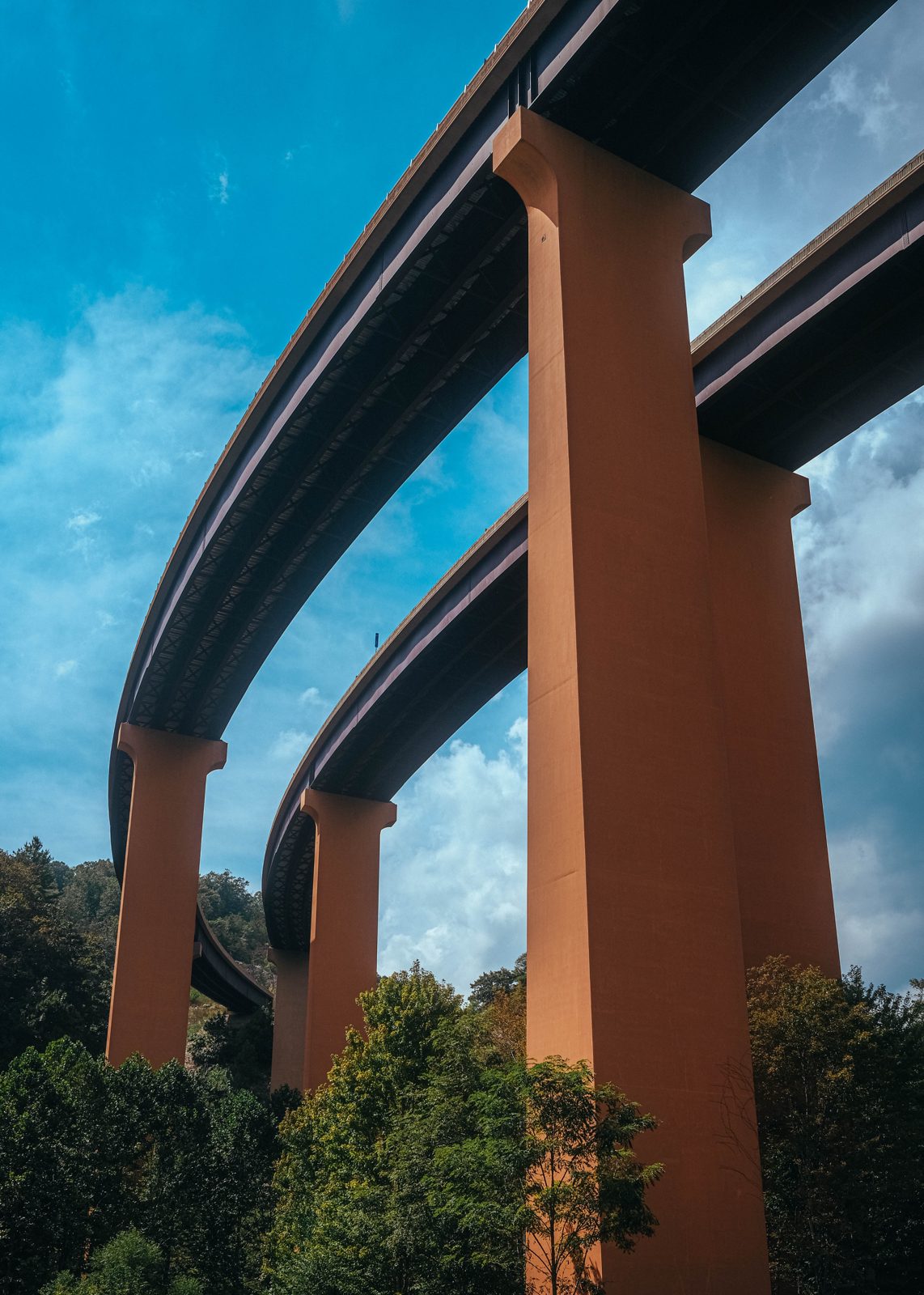
As of 2026, Corridor H runs continuously from just shy of Wardensville to just shy of Davis, leaving both towns relatively undisturbed for now. It’s only in venturing out a little ways from Davis (eastbound) or Wardensville (westbound) on initially mild two-lane state roads that the four-lane expressway unfurls, abruptly, across the landscape, a vast contraption of towering bridges over tight hollers and concrete shelves replacing entire mountainsides. Earth has been moved here at unimaginable scales.
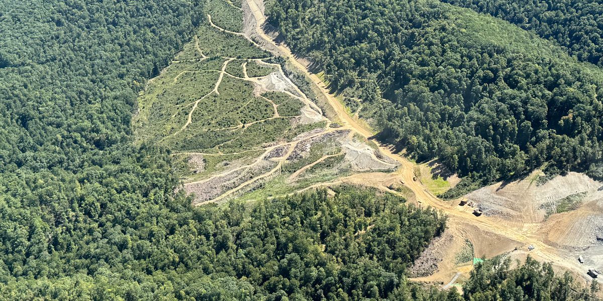
“Stretching from Moorefield to Forman, this job features the moving of 10 million yards of material, the largest grade and drain project awarded in the state of West Virginia,” the website of the JF Allen Company, a Corridor H contractor, boasts.
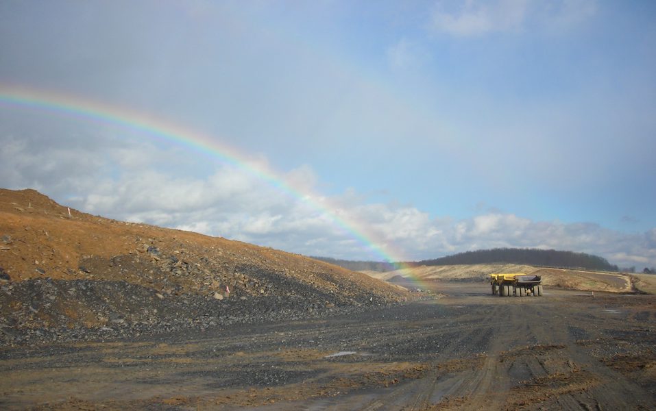
It’s important to emphasize at this point that no one drives on Corridor H. There are other cars and a few trucks, yes, but it’s like driving the quietest, ruralest Interstate highway you can think of in the middle of the night.
To put numbers to it, the few-mile section of Corridor H immediately west of Moorefield got around 3,200 vehicles a day (AADT) in 2025; by the time the highway reaches Davis, it’s 2,100 vehicles. Meanwhile, a segment of Interstate 79 near the far western terminus of the Corridor saw 48,000 vehicles a day. The busiest highways in the country hit over half a million vehicles a day, on average.
This disuse is despite Corridor H being the current fastest (and by far most scenic) route between Charleston and Washington, DC even before full build-out. (The other, all-Interstate route takes Interstate 79 north to connect to Interstate 68 and then 70.) For what it’s worth, Corridor advocates blame outdated online maps for this, though Google Maps circa 2026 is happy to offer this route when a trip from Charleston to DC is requested.
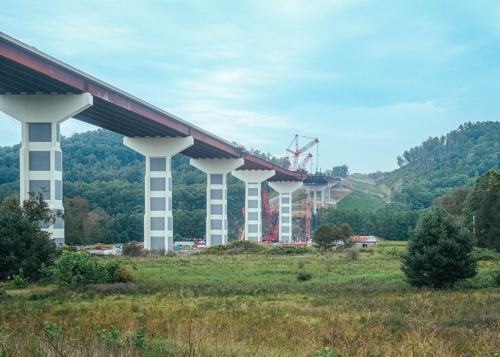
In 2026, we’re left with two unfinished gaps in Corridor H. The first is the Davis/Thomas gap. In 2024, just before construction was to begin, the feds asked the state of West Virginia to consider the alternate route north of Thomas, sparing Blackwater Falls and keeping the sister cities together. That’s how it stands today, with a decision (from a very different administration) expected in 2027. This section, which requires construction of a colossal new bridge over the Cheat River and a climb up 3,600 foot Backbone Mountain, is projected to cost nearly $800 million, or $100 million per mile.
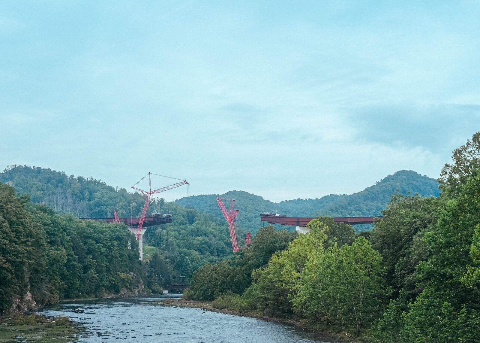
The second gap is almost certain to never be finished, regardless of “national security implications.” This is the 20 or so miles between Wardensville, WV and Interstate 81 at Strasburg, VA. Currently, this span is covered by US Route 48, just two lanes here, which twists its way up and over Great North Mountain. Looming over the Shenandoah River valley, the ridge-line summit of said mountain marks the border between West Virginia and Virginia.
Crucially, this 20 mile segment is actually two segments. The first is the West Virginia portion, which runs nine miles up to the state border. It’s planned and has received an initial funding package of around $85 million for the first three-mile slice of expressway. The total cost is estimated to be around $542 million, or roughly $60 million per-mile. As of this summer, it’s also being litigated.
It seems likely this segment to Virginia will be completed. What won’t be completed is the 14 miles of Corridor H that lie in Virginia, the crucial connection to the East Coast Interstate system that’s going to make it all worthwhile.
Looking at it geographically, there is no question that a finished Corridor H would be a major part of any Capital-area evacuation plan
The problem is that Virginia doesn’t care. It gets precisely nothing out of spending hundreds of millions of dollars on an expressway—even a busy expressway—to West Virginia. It’s done the math, counted the cars and trucks, and the existing two-lane highway is more than sufficient for the next generation or so of traffic increases:
VDOT conducted a sensitivity analysis for the study corridor to determine operational impacts which may result from improvements along West Virginia’s Corridor H. The analysis shows that conditions should remain acceptable through 2102, even when considering a conservative 3% growth rate, which is higher than the 1.43% growth rate stated in WVDOH’s Corridor H Supplemental Environmental Impact Statement
Virginia formally turned against the Corridor H project in 1995 following years of heavy public opposition. Just like that, Corridor H, the Robert C Byrd Highway, became the “highway to nowhere.” More precisely, it became a highway to an awkward traffic constriction at the Virginia state line that likely won’t make much of a difference because, again, nobody drives on Corridor H.
The Virginia segment got a bit of attention in 2009 when the Obama administration, spurred by the man himself Robert C Byrd, delivered $40 million to the West Virginia Corridor H project via normal appropriations and the first economic stimulus bill of the Great Recession.
“The [West Virginia] State Division of Highways said the money will create 60 jobs lasting between 18 and 24 months,” CNN reported at the time, “which works out to $175,000 in taxpayer dollars a year for each job created.” Figure the state would also get around a mile of highway out of it, optimistically.
Around 2006, following the Hurricane Katrina tragedy in New Orleans, a new line emerged from some West Virginia politicians, led by, again, Robert C Byrd: Corridor H needed to be completed in case Washington DC ever needed to be evacuated in an unspecified emergency. The whole city (pop. 6,304,975) just might need to stream over Great North Mountain on four-lane Corridor H and find refuge in Wardensville (pop: 250), Moorefield (pop: 2,527), Davis (pop: 595), and Elkins (pop: 6,950). (Yes, the Corridor H expressway serves a combined population of around 10,000 people.)
“Corridor H is needed now more than ever,” Byrd exhorted, according to the Intermountain, the local newspaper in Elkins. “Looking at it geographically, there is no question that a finished Corridor H would be a major part of any Capital-area evacuation plan. If a disaster were to strike the nation’s capital, sparking an evacuation like we saw in New Orleans, Corridor H could help to significantly reduce the burden on an already overtaxed system of roads and highways.”
It was a desperate and bad-faith argument, of course. It also doesn’t work as a matter of simple traffic arithmetic (Interstate 66 has fixed four-lane capacity, which is already divided into two four-lane directions at its terminus at Interstate 81 near Strasburg, VA; why a third four-lane direction? A single additional westbound lane is going to save DC?).
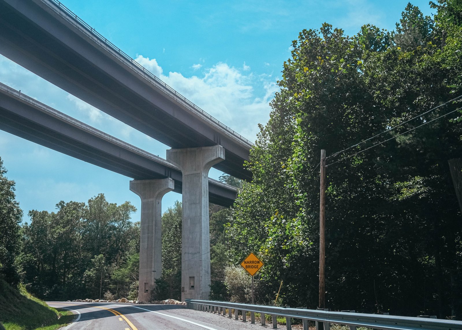
Some large part of what makes Corridor H remarkable is that ongoing public megaprojects in the United States are scarce. A light-rail line or airport terminal is one thing, but Corridor H is revising entire mountain ranges.
Part of what enables such a megaproject in an era in which a couple miles of new subway can cost billions of dollars is that it’s possible to build a highway in tiny slices and, crucially, to spend money in tiny slices. For example, the Wardensville-to-Virginia segment is around nine miles, but it’s divvied up into four phases. Only the first few miles have been funded so far.
It’s not really possible to slice up a new train line in the same way. This is where you run into the concept of the minimum viable segment: the smallest part of a project that can be built and still be useful. Three miles of four-lane expressway spliced into an existing highway or connecting two highways or towns is still “useful,” but the same can’t be said for trains. Three miles of high-speed rail connecting two stations would be nonsensical. Cut a freeway project up over 60 years, however, and it takes the sting out of the billions of dollars spent on it.
Robert C Byrd—he of the Robert C Byrd Highway, Robert C Byrd Freeway, Robert C Byrd Expressway, and Robert C Byrd Highway System—was a US Senator for most of the 60 years that Corridor H has been in development. He died in June 2010, just a few months before the $30 million South Branch Potomac River Bridge opened in Moorefield. One of the last statements Byrd made was from a hospital bed in 2009 after securing yet another $4.5 million slice of federal funding: “Corridor H is my transportation crusade.”
With advocates ranging from JFK to Lyndon Johnson to Obama to Joe Biden, Corridor H has been for most of its life a blue crusade. 15 years ago it was a conservative villain, in fact, a classic case of Washington pork. With West Virginia turning fully red, that has changed. When the Elkins-to-Parsons segment opened this past summer, it was with a coterie of Republican politicians in attendance (minus Jim Justice and Babydog). Federal Highway Administration Administrator Sean McMaster was also on hand, quipping that in the future Americans can expect projects like Corridor H to move at “Trump speed.”
nothing yet.
reply on bluesky